Two New Islands Rise by Anak Krakatau After 25-Hour Eruption
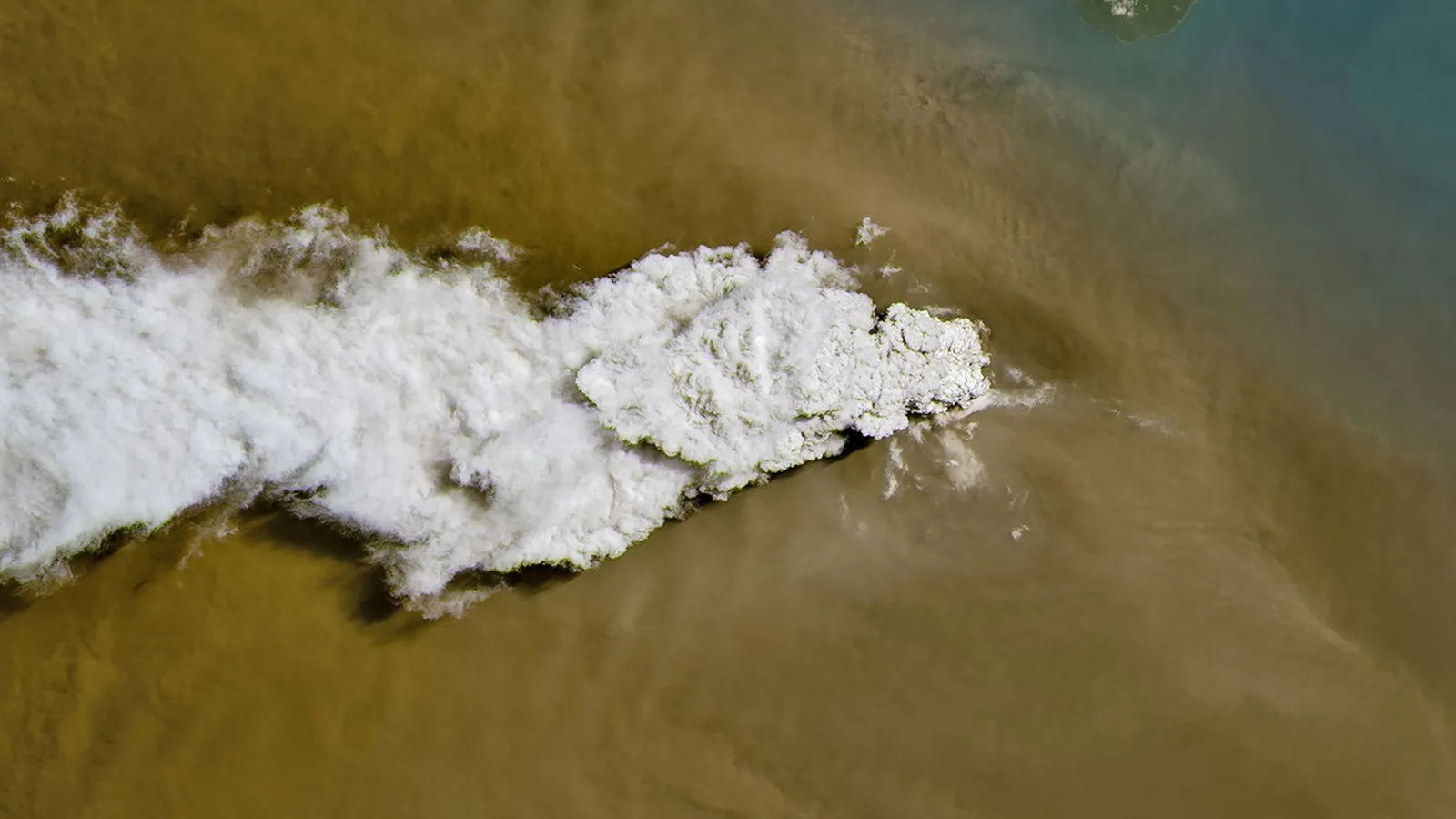
Indonesia's Geological Agency has detected two new islands in the Sunda Strait, one on either side of the volcano Anak Krakatau. One sits 760 metres off the volcano's northwestern coast, the other 495 metres off its southeastern coast. "If connected by a straight line, they form a northwest-southeast alignment, with the main crater located between them," Acting Head of the Geological Agency Lana Saria said in a report delivered in Jakarta on Thursday, 24 September 2026.
The existence of the islands was confirmed by reports from mariners and volunteers together with an analysis of Sentinel satellite imagery dated 23 September, the agency said. Lana linked their appearance to the continuous eruptions of 4-6 September 2026. That roughly 25-hour episode triggered a heavy lava flow and enlarged the body of the volcano by 32.8 hectares.
Anak Krakatau is a small volcano sitting between the Indonesian islands of Java and Sumatra. NASA's Earth Observatory, which published a Landsat 8 image of the eruption plume on 9 September, reported that Indonesia's meteorological agency measured ash reaching 6,000 metres east of the volcano and 15,000 metres to the west by 6 September. Citing news reports, NASA said the ash temporarily closed eight airports on Java and Sumatra and disrupted nearly 3,000 flights, and that air quality fell in parts of the country including the capital, Jakarta.
The agency lowered Anak Krakatau's activity status from Level III (Siaga) to Level II (Waspada) with effect from 21 September, and issued updated hazard zones alongside the island finding. The public and tourists are barred from entering within two kilometres of the main crater and within one kilometre of either new island. The alert level came down on 21 September and the islands were confirmed two days later, on 23 September, so the restricted map grew after the warning status had already been eased.
What the two landmasses actually are remains open. Lana said her team still needs further data and analysis to determine whether they represent new eruption vents or accumulations of secondary eruptive material. She also urged residents along the Banten and Lampung coasts to stay calm, disregard unverified tsunami claims and follow safety instructions from the local disaster mitigation agency, BPBD.
Sources
- ANTARA NewsAgency
- RRI (Radio Republik Indonesia)Agency
- NASA Earth ObservatoryPrimary source
Related
New Gut Bacterium C. immunis Cut Visceral Fat in Obese Mice
934 Roman Denarii: Germany's Largest Hadrian-Era Hoard
Third Beluga From 30-Whale Rescue Dies at Chicago's Shedd
Amoeba Breeds at 63°C, Past the 60°C Limit for Complex Life
First Diplodocus Found Outside North America, in Spain
1,200 Gravity Readings Revive King Tut Hidden-Chamber Debate
Stanford Study: Human Brain Grows From Two Separate Origins
Northwestern Study: Disorder Can Make Networks Stabler
Trending now
- Zhang Zhanshuo, 19, First Swimmer With 7 Golds at One Asian Games
- 996 Zyxel Switches Looted in 48 Countries; Patch Due Sept. 24
- New Gut Bacterium C. immunis Cut Visceral Fat in Obese Mice
- Meta's 100-Gram VR Glasses Cost $1,299.99, Ship Spring 2027
- Kurihara, 11, One Win From Youngest Asian Games Medal
- Yu Zidi, 13, Wins Third Asian Games Gold in 4:28.56 400 IM
- Haaland Passes Ronaldo and Zlatan With 64th Norway Goal
- Check Point: VPN Flaw Under Attack Since Sept. 12, Patch by Sept. 25
Comments
No comments yet. Be the first.