Hurricane Watch for Hawaii; NHC Forecasts Up to 35 Inches of Rain
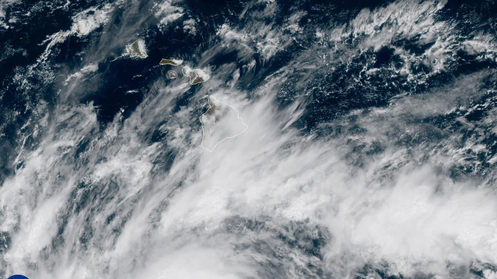
The National Hurricane Center placed Hawaii County under a hurricane watch and added a tropical storm warning for the same county on Thursday, Sept. 24, as Tropical Storm Nolo crept north toward the Big Island with maximum sustained winds of 70 mph.
Advisory No. 17, issued at 11 a.m. HST (2100 UTC) by the Central Pacific Hurricane Center in Honolulu, put Nolo's center near 14.9 North, 156.1 West — about 285 miles south of South Point, Hawaii, and 455 miles south-southeast of Honolulu — moving north at just 2 mph with a minimum central pressure of 992 mb. Forecasters expect Nolo to reach hurricane strength Thursday night and major hurricane strength by the weekend, then turn sharply west on Saturday, Sept. 26, in the vicinity of the Big Island. A tropical storm watch was also issued for Maui County, covering Maui, Lanai, Molokai and Kahoolawe.
Rainfall is the headline hazard. The NHC forecasts 15 to 30 inches on the Big Island with maximum amounts of 35 inches, rain that "could produce catastrophic life-threatening flooding and mudslides, especially in areas of steep terrain." Maui is forecast to receive 5 to 10 inches with maximums of 20 inches. The advisory also warns of 1 to 3 feet of storm surge above ground level in Hawaii County and life-threatening surf along exposed east- and south-facing Big Island shores beginning Friday, Sept. 25.
The Hawaii Emergency Management Agency, whose key messages were last updated at 11:35 a.m. on Sept. 23, tells residents to review family emergency plans, check supplies, prepare for power outages and "consider evacuating to a safer shelter, especially if you are in southeast Hawaiʻi Island." That is a recommendation rather than a mandatory order, and the agency's page says shelters will be listed as they open. HIEMA words the Big Island rain slightly differently — widespread totals of 15 to 20 inches with isolated totals of 35 inches — and puts Oahu, Molokai and Lanai at up to 4 inches and Kauai at up to 2.
HIEMA's Wednesday snapshot had Nolo 310 miles south of South Point with 40 mph winds; the NHC advisory exactly 24 hours later put it 285 miles out at 70 mph. The storm gained 30 mph in a single day while closing only 25 miles of that distance.
The NHC expects tropical storm conditions to begin in the warning area by late Friday, with hurricane conditions possible early Saturday. No landfall is forecast — the center describes a close pass and a westward turn near the Big Island — and no damage, injury or casualty figures exist. Complete advisories are issued at 5 a.m., 11 a.m., 5 p.m. and 11 p.m. HST.
Sources
Related
M6.4 Papua New Guinea Quake Felt 425 km Away in Port Moresby
Typhoon Dujuan Nears Tokyo at 965 hPa; JR East Halts Chiba Lines
Navajo Nation Flood Kills 3, Including 7-Year-Old, Near Newcomb
Category 3 Hurricane Lowell Set to Pass Near Kauai
Krakatau Ash Shuts 8 Airports; Indonesia Starts Cloud-Seeding
Nepal Raises Flood Missing Toll to 6,150 After District Check
Two New Islands Rise by Anak Krakatau After 25-Hour Eruption
New Gut Bacterium C. immunis Cut Visceral Fat in Obese Mice
Trending now
- Two New Islands Rise by Anak Krakatau After 25-Hour Eruption
- New Gut Bacterium C. immunis Cut Visceral Fat in Obese Mice
- Meta's 100-Gram VR Glasses Cost $1,299.99, Ship Spring 2027
- Kurihara, 11, One Win From Youngest Asian Games Medal
- Yu Zidi, 13, Wins Third Asian Games Gold in 4:28.56 400 IM
- Haaland Passes Ronaldo and Zlatan With 64th Norway Goal
- SEC Grants 5-Year Exemption for Tokenized Stock Trading
- Check Point: VPN Flaw Under Attack Since Sept. 12, Patch by Sept. 25
Comments
No comments yet. Be the first.