Typhoon Dujuan Nears Tokyo at 965 hPa; JR East Halts Chiba Lines
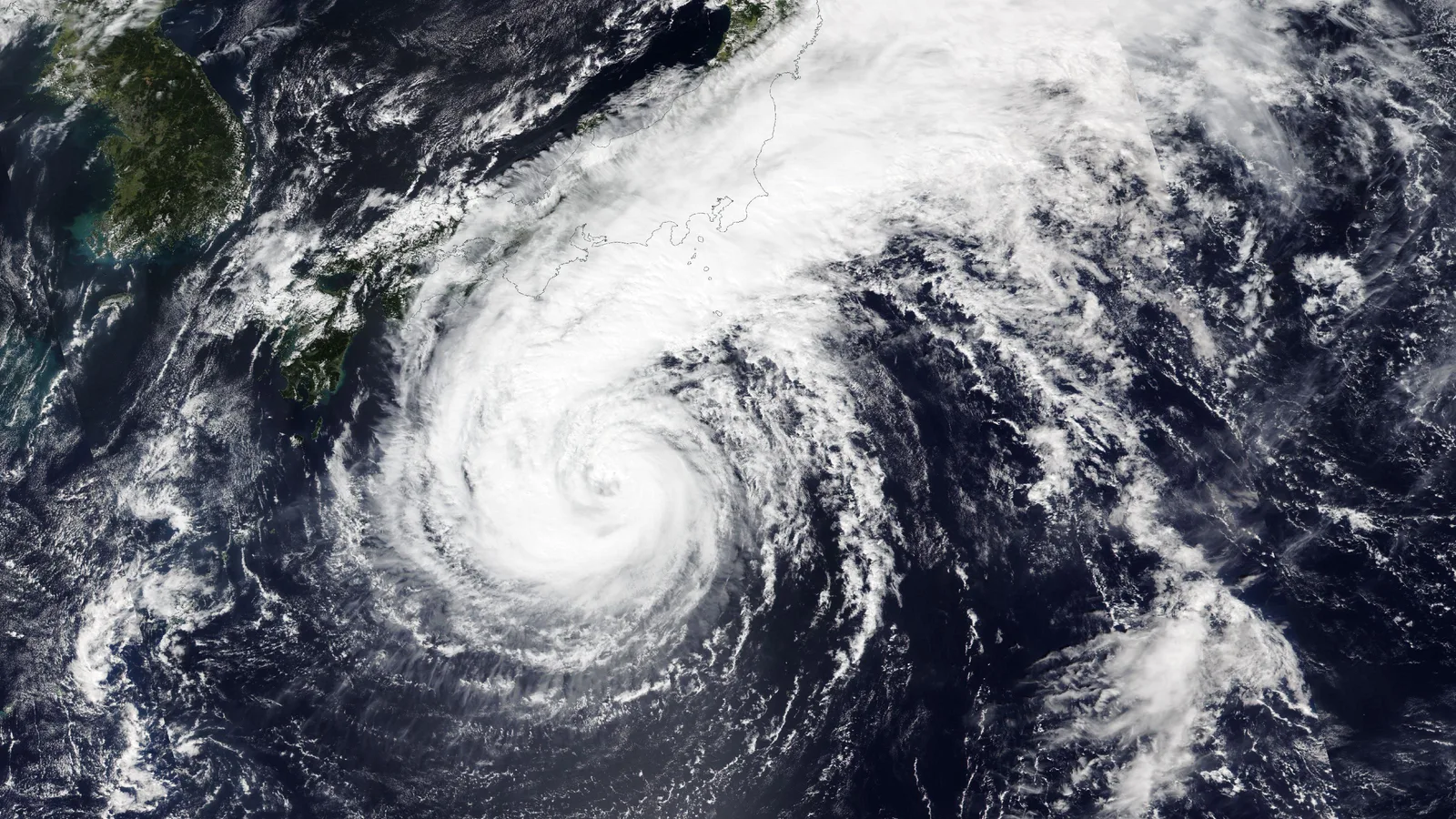
The Japan Meteorological Agency's bulletin issued at 4:45 a.m. on Monday, 21 September (JST) placed Typhoon Dujuan — the season's 25th typhoon — about 240 kilometres southwest of Hachijojima, moving north at 20 km/h. The agency measured a central pressure of 965 hectopascals, maximum sustained winds of 35 metres per second near the centre and gusts of 50 m/s, roughly 180 km/h. JMA classifies the system as "large" and "strong": gale-force winds reach up to 700 kilometres northeast of the centre and 440 kilometres to the southwest.
That is a stronger storm than the one the agency described a day earlier. On the morning of 20 September, JMA put Dujuan's central pressure at 975 hPa and warned that it could make landfall on the Boso Peninsula in Chiba Prefecture, east of Tokyo, as Japan Today and public broadcaster NHK reported. The Monday track keeps the centre over water: north-northeast past the Izu Islands through the day, about 60 kilometres northwest of Hachijojima at 3 p.m., then accelerating northeast off the Boso coast in the evening and reaching a point some 240 kilometres east-northeast of Choshi by 3 a.m. on 22 September. The zone of violent winds around the centre still measures 140 to 230 kilometres, and JMA's forecast circle widens to 50–55 kilometres by the evening, so the exact line remains open.
The timing is what raises the stakes. The approach falls inside Silver Week, Japan's five-day autumn holiday, when domestic travel peaks. East Japan Railway has already published closures for 21 September: the Kururi Line between Kisarazu and Kazusa-Kameyama is suspended all day, the Uchibo Line between Kimitsu and Awa-Kamogawa and the Sotobo Line between Honda and Awa-Kamogawa from around 2 p.m., the Hachiko Line between Komagawa and Yorii and the Togane Line from around 3 p.m., and the Sobu Main Line between Sakura and Choshi, the Narita Line between Narita and Choshi and the Kashima Line from around 4 p.m. until the last services, according to TRAICY Global. The Ome Line between Ome and Okutama stops from around 2 p.m. until about 10 a.m. the next morning, and the Shinjuku Sazanami and Shiosai limited express services 7 and 14 are cancelled. The Tokyo Game Show had already dropped its 21 September closing day.
JMA has urged residents of the Izu Islands, Kanto and the Pacific coasts of Tokai and Tohoku to stay alert for torrential rain, violent winds, high waves, landslides and flooding in low-lying and underground areas, forecasting up to 150 millimetres of rain in the 24 hours to 6 p.m. Sunday in the Izu Islands and Kanto and 120 millimetres in central Tokai.
No official casualty, injury or evacuation figures have been released. Gust readings quoted on 20 September differed — Japan Today cited 162 km/h from JMA, NHK cited 180 km/h — and the agency's Monday bulletin lists 50 m/s. JMA expects Dujuan to weaken to 984 hPa far east of Japan by 3 a.m. on 23 September.
Sources
- Japan Meteorological AgencyPrimary source
- Japan TodaySecondary
- TRAICY GlobalSecondary
- The Nation ThailandSecondary
Related
Navajo Nation Flood Kills 3, Including 7-Year-Old, Near Newcomb
Category 3 Hurricane Lowell Set to Pass Near Kauai
Krakatau Ash Shuts 8 Airports; Indonesia Starts Cloud-Seeding
Edouard Makes Landfall, Cuts Power to 75,000 in Texas
Nepal Raises Flood Missing Toll to 6,150 After District Check
Sinabung Erupts Again, 615 Evacuated in North Sumatra
Grand Canyon Flood: Missing Count Drops From 15 to 1
Texas Ross Fire Grows to 85,000 Acres, 26% Contained
Trending now
- Claude Leads 26% of Anthropic's AI R&D, Up From 1% in March
- Plugin4Shell: 4 AI Coding Agents Hit, 2 Still Unpatched
- Google Says Gemini Hacked Three Real Companies in May Test
- Helldivers 2 Off UK Steam Store Since Sept 16, Sony Responds
- Sharks Feed on Beached Whale in Jamaica; NEPA Warns Swimmers
- OpenAI Sees $278B Cash Burn, $856B Compute Bill by 2030
- NASA Confirms McGetchin: 222-Meter Moon Crater Formed in 2024
- Microsoft Discloses CVSS 10.0 Azure AI Foundry Flaw, Already Fixed
Comments
No comments yet. Be the first.